|
MIllers Dale, Chee Dale
|
|||||
|
|
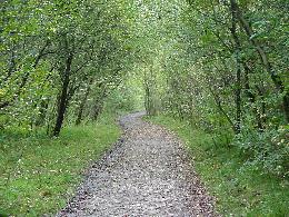
From the parking area, pass through the wrought-iron gate and follow the wide path signed Monsal Trail, passing by the remaining buildings of the disused railway station on your right. Walk parallel to the former platform, following the way signed Monsal Trail, Chee Dale, Buxton going right to do this. Ignore a side path leading off to the left and continue heading west along the level pathway. Turn off left along a narrow path, passing by another sign reading Monsal Trail, Miller's Dale and a board telling you about the flora you can see along the way.
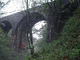
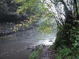
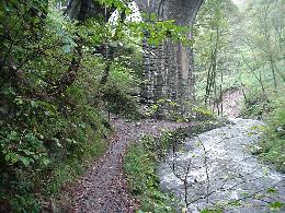
The continuation way passes beneath an impressive high stone bridge now redundant. Immediately after passing beneath this arch ignore a steeped way signed Monsal Trail leading up to the right, we will use these steps on the way back. The path then narrows as you go forward upstream and further on you must ignore a railed metal bridge and continue in the direction again signed Chee Dale.
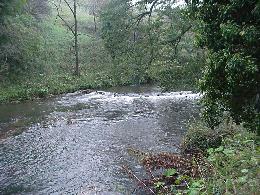
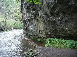
The way then leads for some distance beneath a rock overhang, which is favoured by climbers. Watch out for the drips of water that fall of the porous limestone above. Towards the overhang the way up stream is across partly submerged stepping stones, which disappear below the surface of the water when the river is in full flow.
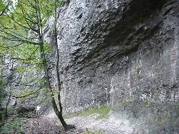
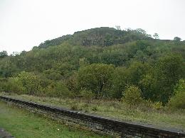
You will now pass more limestone overhangs followed be on area of scree on the steep slopes to your right. High limestone cliffs then appear ahead providing even more spectacular scenery and you will then come to some more steeping stones below another limestone overhang. The narrow way continues to take you through craggy ground now heading towards a really domination vertical limestone cliff positioned on the far side of the river. Another disused railway arch comes into view and you must ignore steps leading off to the right and cross over a wooden stile ahead.
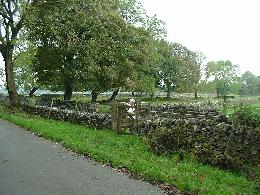
Cross over the cattle grid at Alsop Farm after which the walled lane swings sharply left. Ignore a w-stile on your right as you continue north along the flat surfaced lane. However a short distance on you should turn right and then left along a signed public footpath which is accessed through a wooden gate. You can carry on this lane instead of turning off and access the field by a gate to your right.
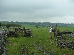
Climb out of the Dale keeping to the stoney path which reverts to a grass at the top to lead through a g-stile in a stone wall head After this the grassy path tracks further north east towards Wormhill passing through another G-stile to reach the farm buildings that signifies you have reach Hassop Farm. Either pass through two gated g-stiles or walk to the gate along the dry stonewall and go right between the farm buildings to reach the road ahead.
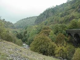
A narrow but clearly marked path the tracks east south east parallel to the meandering River Wye far below at the bottom of the densely wooded dale. The path then leads gradually down to, the floor of the Dale, crossing a section of rocks, which can be very slippery so please be careful. The descent brings you into Chee Dale opposite the railed footbridge, which you passed earlier in the day. Turn left to retrace your steps along the dale as far as the first viaduct. This time branch off up the stone steps just before the bridge following the way signed Monsal Trail.
|
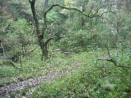
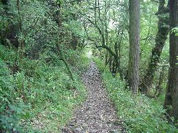
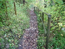
The way descends by steps to reach the River Wye flowing below between the wooded banks. Turn a sharp right before reaching the road to pass through a gap in the stonewall, and then turn right again to walk north west along Chee Dale beside the river. The wide obvious path leads west close to the river through the steep-sided wooded dale. Keep a look out for some of the pretty flowers along this tiny area.
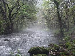
The Dale then widens as the River Wye tumbles down a succession of low and irregular stone weirs. The dale then narrows once more and you will have to negotiate a craggy protrusion of exposed rock. After this you will cross a plank bridge over the stream ignore a path leading you out of the dale to Wormhill instead bear left over a w-stile and cross another bridge. The continuation path leads uphill backtracking for a short distance before curving to lead further southwest along and above the river. The slippery sometimes muddy path threads over limestone crags back down to the bed of the river please take care on this short descent, there is often more mud underfoot as you pass by these splendid vertical limestone cliffs on the far side of the river.
Cross over another wooden footbridge,
which is positioned near to another impressive arched bridge that you go
under after turning right along the continuation path. From here a
stepped way leads further upstream continue along Chee Dale ignoring a
signed path going up to the left and signed To Monsal Trail. A
short distance further on you re-cross the river over another wooden
bridge. A sign now tells you about the nature reserve and asks you to be
careful not to disturb the wildlife.
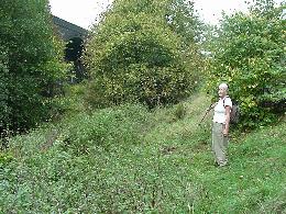
Just before reaching a gap in a stone wall and as another viaduct comes into view veer right along a narrow diagonal path which leads initially through nettles on an upward path out of the Dale. Bare right again further up to continue climbing the hillside keeping to the wide grassy path. Further on, the obvious way zigzags up the steep grassy slope, towards the top of the hill ignore a grassy way, which leads through a gap in a wall on your left. Eventually the upward slope levels off and a short distance further on you should climb over a w-stile to the left of a metal gate. Turn right along the route signed Public Bridleway to head east-northeast past Mosley Far. The path upgrades to a farm lane signed Wormhill as you ignore the turning to the left.
Walk diagonally across the adjacent field, now heading northeast towards the farm buildings across the valley. Keep to this direction crossing more meadows and passing through broken down stone walling using a way signed g-stile to cross one. The route then zigzags downhill and crosses the deep sided grassy valley of Flag Dale where you cross over another w-stile disregarding a path leading off at right angles to the left.
There is now an optional detour to visit Wormhill to do this turn left and follow the road for a short distance until the hamlet comes into view, sit for awhile on the benches before tracing your steps back where you first came out of the road at Hassop Farm. Of course if you don't go just turn right out of the Farm. Walk downhill along the road following it as is curves to the left but then turn off along the public footpath signed Chee Dale and Blackwell immediately passing a bungalow named Chee-Tor Cottage. From here a secluded walled path leads gently downhill beneath trees. Disregard the branch path leading more steeply down on your right and keep to the higher ground by walking along the continuation path, which then bends left along a fairly level land a Chee Dale.
At the top turn left along the Monsal Trail and follow the virtually flat trail along a short distance back to the car park.
|
|||
|
|
|||||