|
Tideswell Dale, Millers Dale, Cressbrook Dale and Tensley Dale
|
|||||
|
|
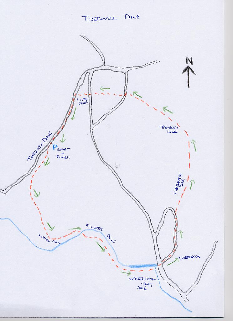
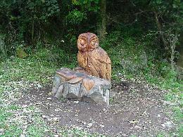
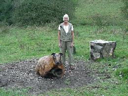
Depart from the picnic car park walking past the information point to enter Tideswell Dale heading south along a wide well surfaced path. The upper section of the Dale contains a mixture of deciduous trees including beech, elderberry hawthorn, hazel, sycamore and willow. Disregard a side track heading uphill on the left signed Picnic area and trail, and keep to the dale bottom as steeper, wooded slopes rise above. Take a look at these wooden carvings they are absolutely wonderful so is the tunnel of trees that you walk through
You will then reach some buildings at Litton Mill where you can stop and have a coffee at the little tea shop. Right opposite the shop or to your right if you have carried on walking access the continuation footpath wayside Trail 200yd Taddington 1.50 miles. I will deviate from the walk at this point because if you do not like heights do not go this way as it does get steep and high and the path becomes very narrow at one point. If this is the case carry on the lane past the old mill and walk to Cressbrook this way. If however you find the courage to go on, like me as I am a little frightened of heights, you will not be disappointed with the views.
Your gravel surface path merges with another and you should bear left at this point immediately passing a group of small caves on your right. From here keep to the main paths that stay high above the Dale at a more or less constant height ignoring all side paths and watching out for some loose ground head. Some distance on the main path descends temporarily and there are two s-stiles to cross at a section of wire fencing just before the Dale swings around sharply to the left. After this the path levels out again and the surface underfoot becomes rougher
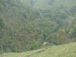
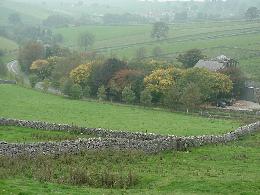
After stopping for awhile to admire this lovely view continue on the path past a building materials compound and onto reach the road. Turn left and take the right lower road signed Cressbrook, Litton 2, walk north uphill beneath trees you now enter Cressbrook Dale or sometimes called Ravensdale. The Dale winds as a steep sided densely wooded valley. Keep walking uphill disregarding a track off to the left until you approach a hairpin bend just before you reach this bear right along a surfaced side lane signed Ravensdale no through road. Keep to this lane passing a row of stone cottages until you reach the sign for Wardlow. Cross the stream via a footbridge where a sign welcomes you to the nature reserve of Cressbrook Dale. Ahead fork left along the lower footpath keeping to the bottom of the Dale where you walk through a damp wood area. The path continues to wind up the valley and a higher path will merge with yours. The combined path then leads beside the bed of a steam.
Continue across two more w-stiles the second of these a squeezer. The way then bends diagonally left to reach another lane which you should cross over. A stile provides access to the continuation of the path which then descends steeply into Litton Dale where you will reach the road opposite Dale House. Go through the g-stile turning left along the footpath adjacent to the road and follow this to the T-junction turn left, or right if you park in Tideswell village 1 mile up the road, and within 20 paces use the stile on your left to access the footpath and follow the path through a covering of trees keeping to the lower ground nearest the road climb over a stile and pass under a line of mature beech trees to re-enter the car park.
|
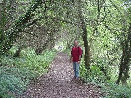
Further on keep left when the paths divide, although these do reconnect further down the valley, Limestone cliff faces now appear as the valley curves around to the right and you will cross the tiny watercourse via wood footbridge. Continue down the meandering dale as more limestone outcrops loom up above to your right and the ground cover thickens up. The Dale now narrows and you will cross another footbridge, lots of nettles in the summer so beware. After passing through an enclosed area to some limestone cliff faces, the path connects to a surface lane. Turn left and walk east along Millers Dale initially through another wooded area where the River Wye comes into view on your right.
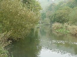
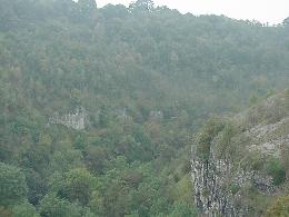
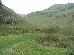
Cross the River Wye climb up the railed steps on the far side and follow the zigzag path leading up and above the steep-sided dale. When you reach the wide Monsal Trail turn sharp left past a sign No Through Road. Trust me. You are now on the path going east to a blocked off tunnel entrance ahead. Before reaching this barrier veer left along the narrow path, again take no notice of a misleading sign saying, No Access, to reach an s-stile and dog gate, I wonder who these are made for? Continue with care along narrow path, going round grassy slopes of the dale and progressively gains height. You make your way along the better path still making your way round and up. Nearing the top the views down into Miller's Dale become increasingly spectacular as high limestone cliffs plunge down into the wooded meandering dale.
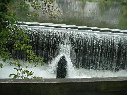
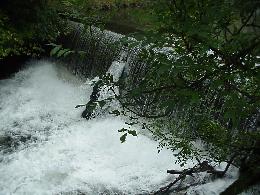
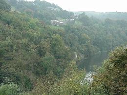
Eventually the buildings of Cressbrook appear on the far side of the Dale with Water-cum-jolly at the base of the near vertical limestone cliffs at the bottom of the valley. You will now have to go over more loose scree so please be very careful. Your path gradually descends into the valley as you connect with a wider path below along which you turn sharp left to continue down towards Cressbrook. Follow the path which takes you to a zigzag flight of stone steps and you will cross the River Wye at the bottom using a wood footbridge positioned just below the weir.
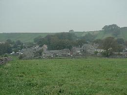
The route then leads you towards Tansley Dale to the west as Cressbrook Dale meanders further north. Use the stepping stones to your left to enter the steep grassy climb. The ground levels off following a final upwards diagonal to your right which terminates at a p-stile. Climb over this and keep to the faint grassy path as it bears right away from the stile. The continuation way skirts the corner of a dry stone wall as it leads towards a w-stile near some gates, turn left along the wide muddy walled track which leads west. Avoid all side paths to reach the surfaced road a short distance on. Bear slightly left along this heading away from the village of Litton When the lane bends sharply to left select the signed public footpath straight ahead accessing this trough a narrow g-stile. Continue along the edge of the adjacent field beside stone walling on your right. Cross the w-stile ahead and walk along the side of the next meadow where the buildings of Litton may be spotted to your right
|
|||